.........................
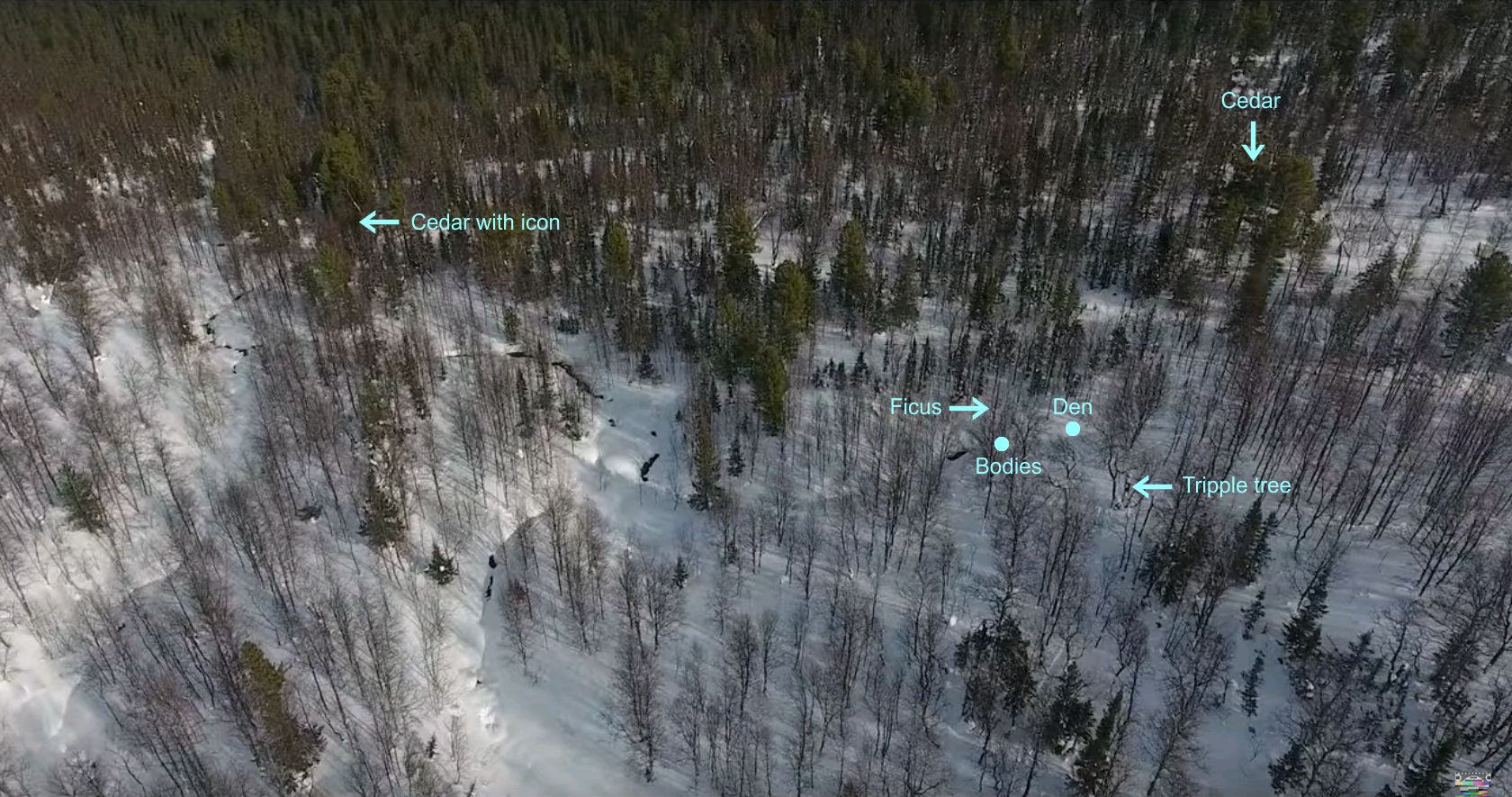
I had always thought the last group of 4 were about 200 yards away from the cedar towards the natural ravine with the stream area but towards the north east more.
What is your opinion on this ? Over the years I m a bit confused because of all the different maps and their placement of the Dyatlov ski tourists.
There are several different opinions about the geographical position of the four of the den. These are mainly the opinions of : Vladimir Borzenkov=WAB - Mihail Sharavin - Aleksey Rakitin - Shura Alekseenkov and Sasha Kan.
I would have liked to place here an aerial image of the cedar's surroundings using Google Earth, but I am not able to do so ... Finally, I prefer the positions of Shura Alekseenkov and Sasha Kan.
So personally I think that the errors are small (tolerable) using the following approximate values :
Cedar : N61°45'53.20" E59°27'17.80" 647m
The bodies : N61°45'53.93" E59°27'14.64" 636m
The bodies are located 50 m from the cedar at azimuth 290° (i.e. 50 m westward plus a few meters northward).
( I was unable to find the coordinates of the tent.... - 1 yard = 0.9144 m).
°°°°°°°°°°°°°°°°°°°°°
The visualization of Vazilii Zyadik was useful to me because it allows me to specify the configuration of the area around the four of the den.
So I add two personal convictions:
Given the depths of snow covering the pebbles and also the relief of the terrain which has no vertical cliffs
a) ••• It is impossible that the bone fractures found on several hikers could be the result of falls or loss of balance.
b) ••• On the contrary, this ravine is very difficult for tracked vehicles and no vehicle was able to pass through above the den.
°°°°°°°°°°°°°°°°°°°°°
The aerial image is impressive, but be aware of the direction of the north (pointing to the left).
